Image
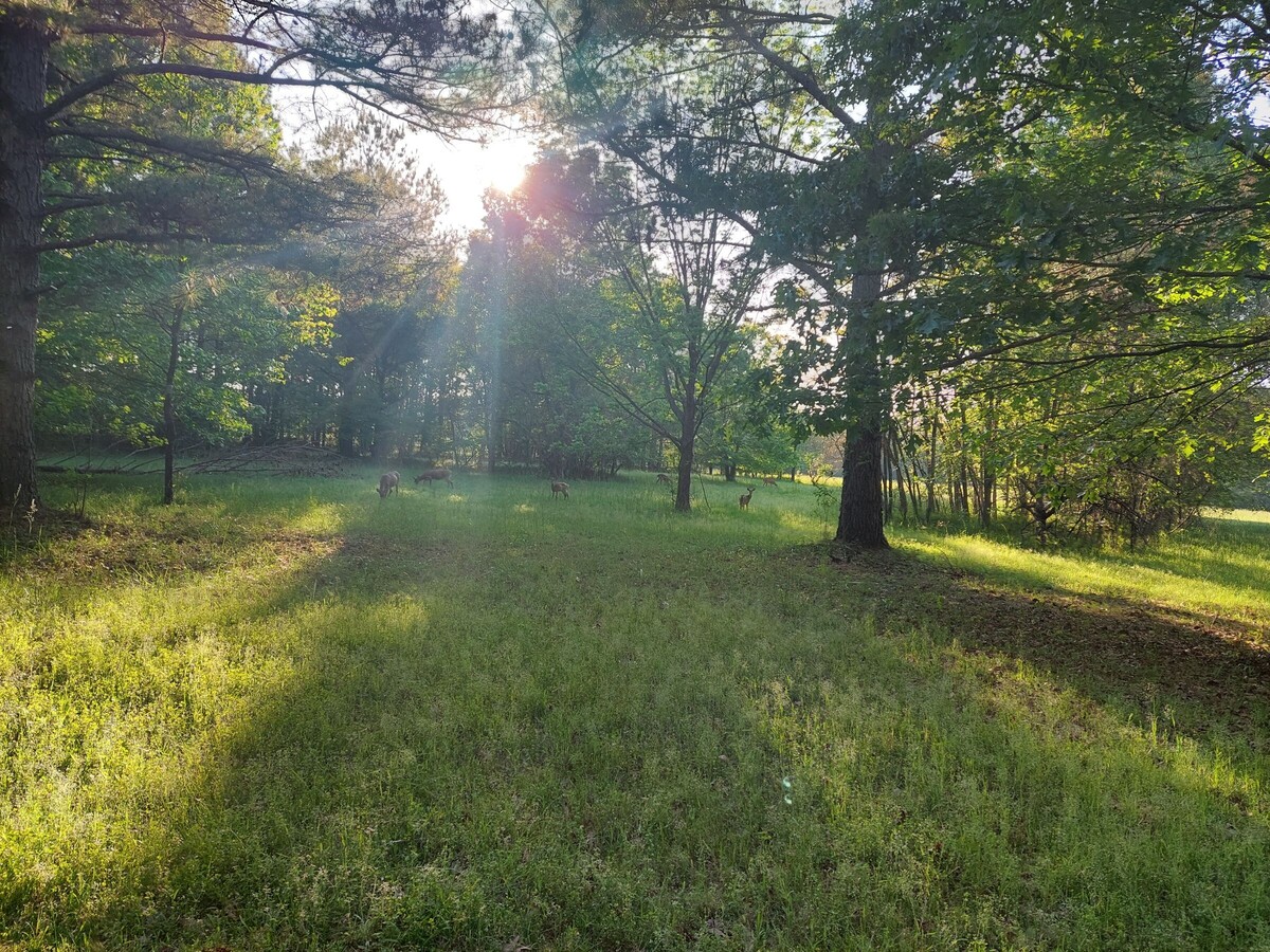
The deer in Middle Georgia know to stay in the shade when the sunshine gets too hot (Photographer Nate Weeks)

Middle Georgia residents should brace for a week of extreme heat, steamy afternoons, and increasing chances of thunderstorms as the region remains under the grip of summer. With heat index values climbing to 110°F on both Monday and Tuesday, the National Weather Service advises limiting time outdoors during peak afternoon hours, staying hydrated, and checking in on vulnerable neighbors. By midweek, expect a shift toward more consistent afternoon and evening storms, with slightly cooler temperatures arriving by the weekend.
MONDAY, July 28th
The week starts off with intense heat under sunny skies. High temperatures will reach 101°F, and heat index values may climb as high as 110°F. A light northwest breeze around 5 mph may offer brief relief.
Monday Night: There's a 20% chance of isolated thunderstorms before 2 a.m. Otherwise, expect partly cloudy skies with a low around 77°F and calm overnight winds.
TUESDAY, July 29th
Hot and humid conditions continue, with a high near 99°F and another round of dangerous heat index values near 110°F. Showers and thunderstorms are likely after 2 p.m., offering potential cooling relief. Winds will shift to the northeast at around 5 mph.
Tuesday Night: Thunderstorms are likely before 8 p.m., followed by mostly cloudy skies. The low will be around 74°F. Chance of precipitation is 60%.
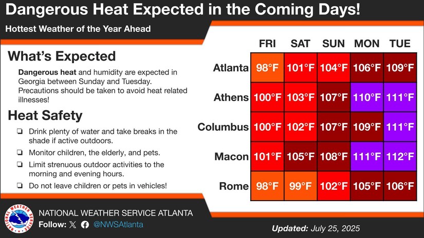 NWS Atlanta is predicting heat index values higher than 110 degrees this Monday and Tuesday (Graphic courtesy of NWS Atlanta)
WEDNESDAY, July 30th
Skies remain mostly sunny, though rain chances increase slightly. A chance of showers and thunderstorms is expected after 11 a.m., with a high near 95°F.
Wednesday Night: A 30% chance of storms lingers into the evening before tapering off by 2 a.m. Low around 74°F with partly cloudy skies.
THURSDAY, July 31st
Sun returns, but there's a 40% chance of afternoon showers and thunderstorms after 2 p.m. The high will be around 96°F.
Thursday Night: A 30% chance of early evening storms, then partly cloudy with a low near 75°F.
FRIDAY, August 1st
Afternoon storms grow more likely, with a 50% chance of precipitation after 2 p.m. under mostly sunny skies. The high will reach around 95°F.
Friday Night: Rain and storms remain possible overnight with a 50% chance of precipitation. Low around 72°F.
SATURDAY, August 2nd
A cooler, wetter weather pattern thankfully sets in on Saturday. Showers and thunderstorms are likely throughout the day, with a high near 86°F.
Saturday Night: Storms likely to continue into the evening. Mostly cloudy with a low around 70°F. Chance of precipitation is 60%.
SUNDAY, August 3rd
More widespread rain is in the forecast (but no complaining - it's way better than a 109 degree heat index!), with likely thunderstorms under partly sunny skies. Expect a high near 83°F.
Sunday Night: Showers continue into the night with a low near 69°F. Winds from the east-northeast at 5 to 10 mph. Chance of rain is 50%.


Patchy rain nearby, with a high of 83 and low of 73 degrees. Mist in the morning, patchy rain nearby in the afternoon, clear for the evening, patchy rain nearby overnight.